3 Favorite Off-the-Beaten-Path Escapes from Salzburg
Hallstatt, the Eagles Nest, and the Ice Caves. These are the most popular places to visit from Salzburg and for a reason. Each of those places is surrounded by stunning natural beauty. Due to their popularity, however, the amount of people visiting in summer is enormous. If you are longing for nature and want a place all by yourself, there are plenty of off the beaten path day trips from Salzburg.
These off the beaten path day trips are what this article is about.
Where to find off the beaten path day trips from Salzburg?
In this article, I will present you 3 of my favorite off the beaten track places around Salzburg. I am not an ex-pat or a tourist blogging about their week in Salzburg. I am a local born in Salzburg and spent all his life here. Each of these places is connected to my life and in this article, I will tell you my story with each of these places.
1. Gaisberg Mountain
When I first moved into the city, I moved to an area called “Schallmoos”. Schallmoos is on the foot of mount Gaisberg, and my apartment was about 15 minutes walking from the trail. When I moved into the old town I lived about 30 minutes from the trail, I kept walking to the mountain instead of taking a bus, whenever I hiked Gaisberg.
That’s what I love about mount Gaisberg. There is no need to check the schedule. Put on your shoes and walk, and you will eventually reach the top. It takes about 3 hours to walk from the old town and climb up to an altitude of 1300 meters. Once you reached the top, you could take the public bus, bus number 151, back down to the old town.
What can you do at Gaisberg mountain?
About half an hour before the top of the mountain, there is the so-called “Rundwanderweg”, a circular hiking trail. It surrounds the hill. The Rundwanderweg is flat and takes about an hour. On that circular hike, you could also go around half of the mountain and finish from the backside, if you feel like.
For those who don’t want to hike up the mountain, you can also take the 151 bus from Mirabellplatz to Zistelalm, to the height where the Rundwanderweg (circular walk) is located, or even to the top. In summer, there will be people on the trail and the mountain, but most of them are locals, and I have never seen a crowd on top or the bus.
If you hike up and don’t feel like hiking down, the bus is your way below. Earlier I always walked back down, but these days due to knee problems, I every time take the bus.
How to get to Gaisberg Mountain?
I love Gaisberg because Gaisberg is hikeable right from the city center of Salzburg. Wherever your hotel or hostel is, it takes you about 30-60 minutes to find the trail. My favorite trail is the one that starts in an area called Gnigl, in Eichstraße 66 Street. That’s also the most hikeable from the city center. Find the house in Eichstraße 66 and you will find stairs next to the house.
These stairs might seem like private property but they are not and next to the stairs you find the signs showing the trail. The sign point all the way to the top. After 20 minutes you reach stairs and at the end of the stairs you will have the first great view of the Alps in the south.
You can’t go wrong and the hike is easy. As long as there is no snow you should be good with any shoes as long as they are not high heels or with no grip.
Even though I always recommend the first option (the trail in Gnigl is most simple and pretty), there are several ways up mount Gaisberg. Another popular route starts in Parsch. You would reach Parsch with bus number 6. Get off the bus at the roundabout at Ludwig Schmederer Platz, the last stop of bus number 6. From the bus stop, you walk 2 minutes to Judenbergweg, where the trail starts.
Ludwig Schmederer Platz on Google Maps
Taking the bus up to Gaisberg
If you are not up for hiking, you could just take bus number 151 from Mirabell square.
The bus takes you to the top. You could also get off at the Zistelalm stop. Zistelalm is on the altitude of the circular hiking trail and about half an hour from the top. Walking around the mountain is relatively effortless. The path from Zistelalm to the top is steep, but it only takes half an hour. The bus costs less than €10,-.
Why you should hike Gaisberg mountain?
Gaisberg is a mountain you can reach all the way walking from the city center of Salzburg, and even though there is a bus going to the top, few people take it. If you hike up and down mount Gaisberg, you don’t need any money, and the few people you meet while walking are usually locals.
There are more beautiful hikes in the area, but most of them require more preparation, gear, public transport, and money. Gaisberg is a real hike. You will walk 2 hours uphill, but it’s not difficult.
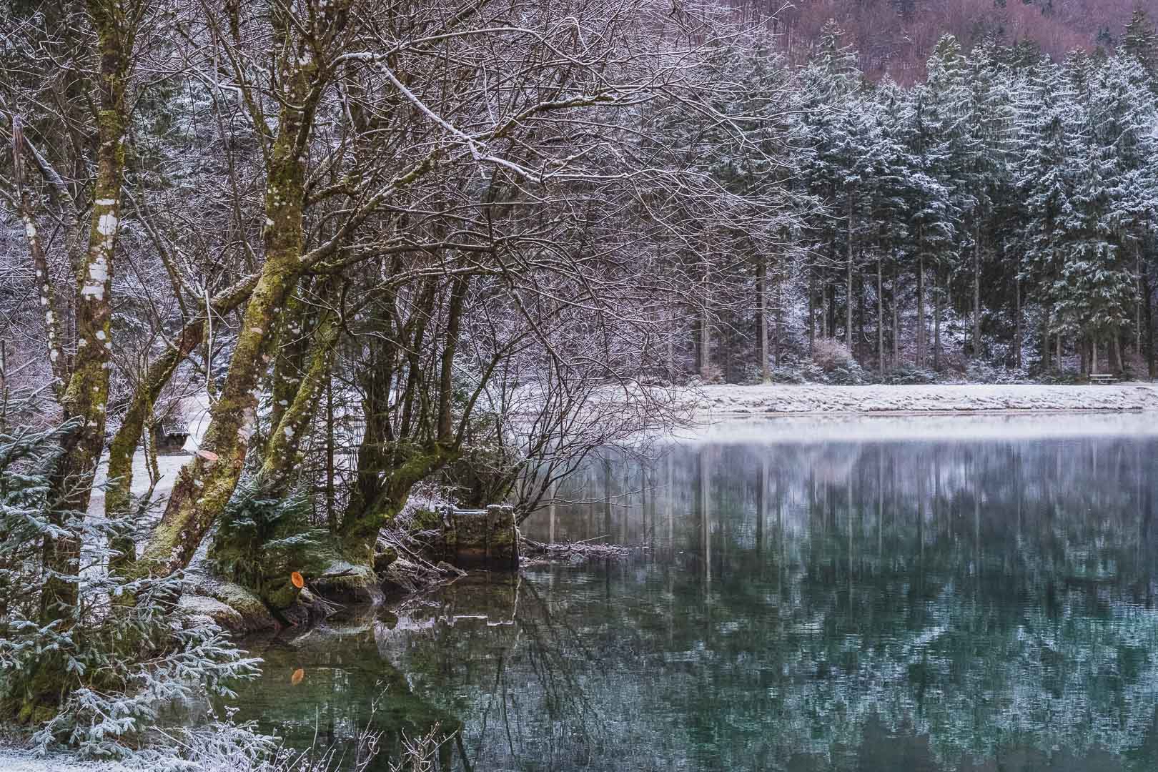
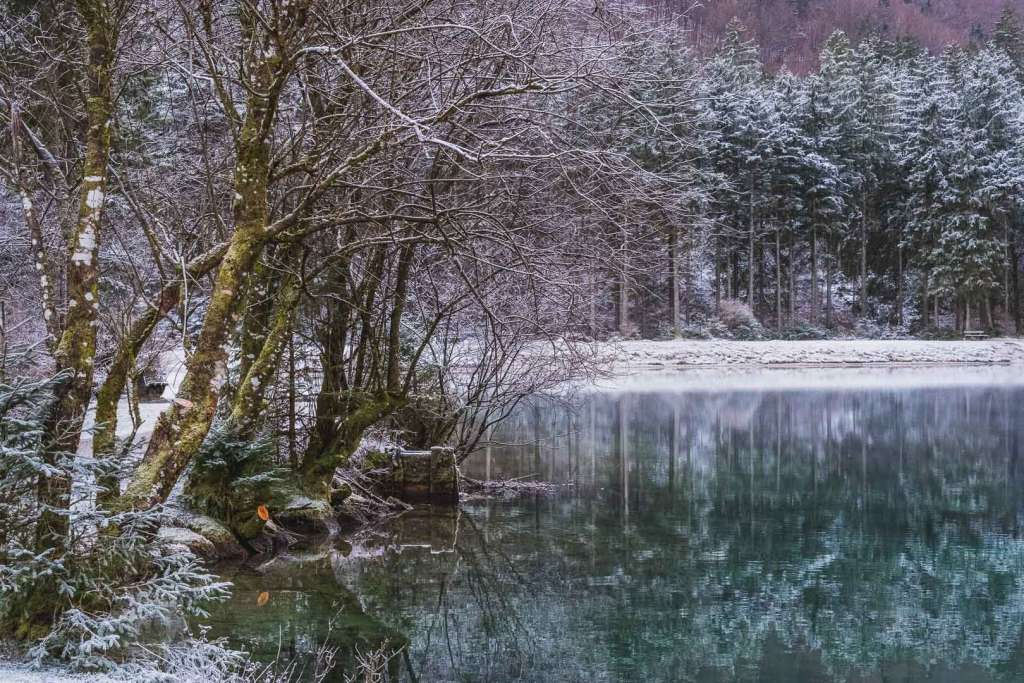
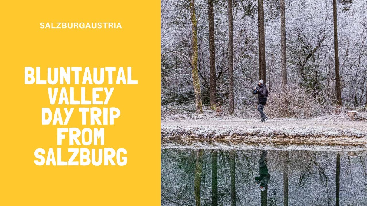
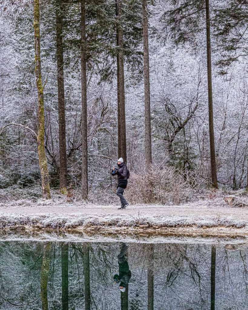
2. Bluntautal Valley and Golling Waterfall
When I was a child, my father wanted to visit Bluntautal every second weekend, but that’s not what I wanted to do. Therefore in mind, Bluntautal remained a dark forest until I was 25 years old. Only when I received visitors from other countries and were searching for things to do near Salzburg, I revisited and realized how pretty this is. Out of all the places I recommend in this article, this is maybe the most stunning one.
What can you do in Bluntautal?
You can walk Bluntautal at any time of the year. The walk is easy; there is no ascent. In winter, sometimes there is snow even when there is no snow in Salzburg. That’s because, in the valley with the mountains on both sides, it’s much colder. There is less sunlight.
Tal in Bluntautal means valley. Walking into the valley takes you about an hour. The valley and your walk start at the small bridge. That’s where you decide if you want to go left or right. I go left when I go into Bluntautal and come back on the right side, but that’s just my habit. On your way, you will come across two lakes. You only see them right away if you went right at the beginning. Otherwise, you will have to get out of your way to get down to the lake on your way into the valley.
Almost at the end of the valley, there is the Bärenwirt restaurant. That’s the only house in the whole valley. I would recommend it for a meal and a coffee. After Bärenwirt, you can continue for 1,5 kilometers more. You would get to a waterfall at the end. That’s where most people turn around and take the road not yet taken back and out of the valley. If you just walk, it will take you about 3 hours.
If you would like to go for serious hiking, there are plenty of options in Bluntautal, but for most of them, you have to be well prepared and get up early. The mountain on the right when facing the valley is Hoher Göll, a mountain 2500 meters high and very hard to climb.
A hike, not as extreme as Hoher Göll but equally long, would be straight across the mountain from Bluntautal over the German border to Berchtesgaden. That hike is 25 kilometers long, so that it would take you something between 8 and 10 hours. So that’s if you are looking for some real adventure.

How to get to Bluntautal from Salzburg?
You get to Bluntautal by train from Salzburg. The S3 with direction to Schwarzach St.Veit runs every 30 minutes and takes you to Golling. Golling is where Bluntautal is located, and the stop is called Golling/Salzach. You get a train ticket from the ticket machine at the train station. A one-way ticket costs you €7,- (in 2020). From the train station in Golling, you reach the beginning of the valley in about 45 minutes walking.
The beginning of Bluntautal Valley on Google Maps
If you are traveling by car, you can drive to the parking, which is only 10 minutes walking from the small bridge and the beginning of the valley. What you should also do if you have a car is passing by the Golling waterfall on your way back to Salzburg. Golling waterfall is not the one I mentioned before, not one at the end of the valley. By car, the Golling waterfall is only five minutes from the parking at Bluntautal, but it would be too far to walk.
Gollinger Wasserfall auf Google Maps
By the way, if you are going to Hallstatt by Car and have some time left on your way back, I would recommend to drive via Golling and take a quick look at Bluntautal or/and the Golling waterfall. Especially after being to Hallstatt, you will appreciate the untouched uninvaded nature.
3. Königseeache River
Out of the four places I present to you, this is the one closest to me. I was born in Hallein. Hallein is a former industrial city 20 kilometers south of Salzburg with a different vibe than Salzburg. No one visits Hallein, and there is not much to do. Therefore when I was in my teens, I was hanging out in the city park and not in the best company.
But that changed when I was 16, and we moved to Rif. Rif is between Hallein and Salzburg. There was even less to do in Rif. Rif is an even smaller place than Hallein, but in Rif it was easy to make friends. Easy because of the River called Königsseeache.
We used to live 5 minutes walking from the river. Instead of meeting in the city park and drinking (yes, we can drink wine and beer from the age of 16), people my age would gather around a bonfire on the side of the river on weekends. That’s what changed my life. There was a much greater sense of community and a lot more hope.
What can you do at Königsseeache?
Nowadays, we may not light bonfires anymore. Shortly after I moved to Rif, things got out of control. Not because of me and nothing terrible happened, but neighbors complained about noise, and fences were used as firewood. Therefore fires are forbidden, and staying at Königsseeache at night is also forbidden now.
At the same time, the island was removed. There was a famous nudist island in the middle of the river. Nothing kinky, just people not wanting to wear clothes which is quite common in Austria. Sauna, for example, is also mixed and all nude. The island is gone, and there is no official nudist area anymore, but you still sometimes see people not wearing clothes.
There are two areas along the river. One is an open space with stones and an area under the trees with sandy beaches. These sandy beaches are rare in Austria, and I would always prefer the sand over the stones. The stones are closer to the end of the river. The place where the Königseeache flows into the Salzbach, into the same river we have in Salzburg while the sand is closer to the main street leading into Rif.
To explore the area, you should walk all along the river.
Königsseeach’s water is cold. Only on hot summer days the water warms up and is refreshing rather than freezing. The ideal time of the year to visit, therefore, is summer, but also in winter, a visit to Königsseeache is worth going for a walk along the river. Mostly because there is no one in winter, if you go in winter, you could walk to the end where the Salzach and the Königgseeach join and follow the Salzach River to the right, upstream, to get this stunning view.
So the main things to do at Königsseeache is sitting on the side of the river, swimming in the cold water, and breathing fresh air. In winter you only want to go to Königsseeache if you are longing for peace and being alone in a beautiful surrounding.
How to get to Königsseeache River from Salzburg?
There are three ways to reach Königsseeache from Salzburg.
In summer you could rent a bike and cycle. It would take you about 30 minutes to get there. Upstream along the Salzach river. At some point, you pass under a red bridge. Just after that bridge, the Salzach river splits up, and you follow the smaller stream to the right. Stay on the left side when going upstream along the smaller river. That’s Rif. On the right side, you would be in Niederalm. There are spots where you can also swim on the Niederalm side, just not as many and not as pretty.

The most common way to go to Rif would be by bus. From the bus stop at Mirabell square, you could take bus number 170 or 175. 175 takes you to the center of Rif. On bus 170 you would have to change to another bus at the “Brückenwirt” bus stop, but you should rather just cross the street and walk down the small path just before the bridge. It takes you down to the river, which you can follow until you reach the sandy beaches.
Another option would be to take the S3 and get off at Puch Urstein. Puch Urstein is on the other side of the Salzach river. That means more walking but I love the path from Urstein to Rif, especially the bridge to cross the Salzach. On a clear day, the view from the bridge is fantastic.
Why visit Königsseeache?
Königsseeache is one of the most peaceful and beautiful swimming and relaxing spots around Salzburg. In summer, locals from the surroundings or even from the city of Salzburg can crowd it. In winter there would be nothing to do but walking along the river, but such a walk would be beautiful and peaceful.
Conclusion
It’s easy to spend days visiting Salzburg’s most popular attractions, but a day trip can be the perfect way to get out of the city and explore the landscapes that surround it. But the best day trip destinations from Salzburg can get crowded. That’s why I’ve put together these 3 day off the beaten path day trips from Salzburg.


